Find out what Ride Holme has been up to…

Tour De Holme Moss
An off road journey around Holme Moss, taking in around 25 reservoirs and covering approximately 40 miles. Link the GPX route at the end of the blog post.

Holme Moss
Rising to the west of Holmfirth on the edge of the Peak District National Park is Holme Moss, with its 228m high radio transmitter station which can been seen for miles around.
The summit plateau comprises mainly of peat bogs and only footpaths cross here. One is the long distance Pennine Way, which now has flagstones to protect the vulnerable peat from the feet of the many walkers making their way north to Kirk Yetholm or south to Edale.
The road to the summit is a favourite among the road biking community. It’s a regular feature on the Tour of Britain race and was a highlight of Day 2 of the 2014 Tour De France Grand Depart.
So, with no permissible routes over the top for mountain bikers and just two roads crossing this bulk of bleak and barren moorland, the A6024 Holme Moss Road and the A635 Greenfield Road, what does this behemoth have to offer the off road cyclist?
I have grown up riding the trails around Holmfirth, hence the name of my guiding business, and I have walked and ridden many of the areas surrounding the summit of Holme Moss. However, until recently, I had never linked them together.

Springs Road above Digley
In early 2020 with the country on lockdown and only essential travel permitted, it made sense to explore from the doorstep.
Initially for me this meant walks in the local woods as the Singletrack Mag, ’No Car, No Gnar, Not Far’ message was spreading amongst the Mountain Bike community. As exercise restrictions lifted, I got the bike out, only going a short distance from home but it was good to be pedalling again.
Three months in and we were allowed to travel for exercise, but I still didn’t want to use the van to get to the trails. After all, I’m lucky to have some fantastic places on my doorstep. But it was time to venture further than my regular circuit.
So one morning, I sat down with a coffee and got the maps out to trace a line around Holme Moss. My aim was to find a route that stuck as close to the edge as possible, using only permitted rights of way with as little road work as possible.
With the route plotted and knowledge of what some of the trails were like, it was time to explore. I was initially going to go in a clockwise direction, but on looking at the profile of the final section I didn’t fancy having the steepest and toughest climbs right at the end of what would be a long day in the saddle, and so I reversed the route on my Garmin and set a date to head out.
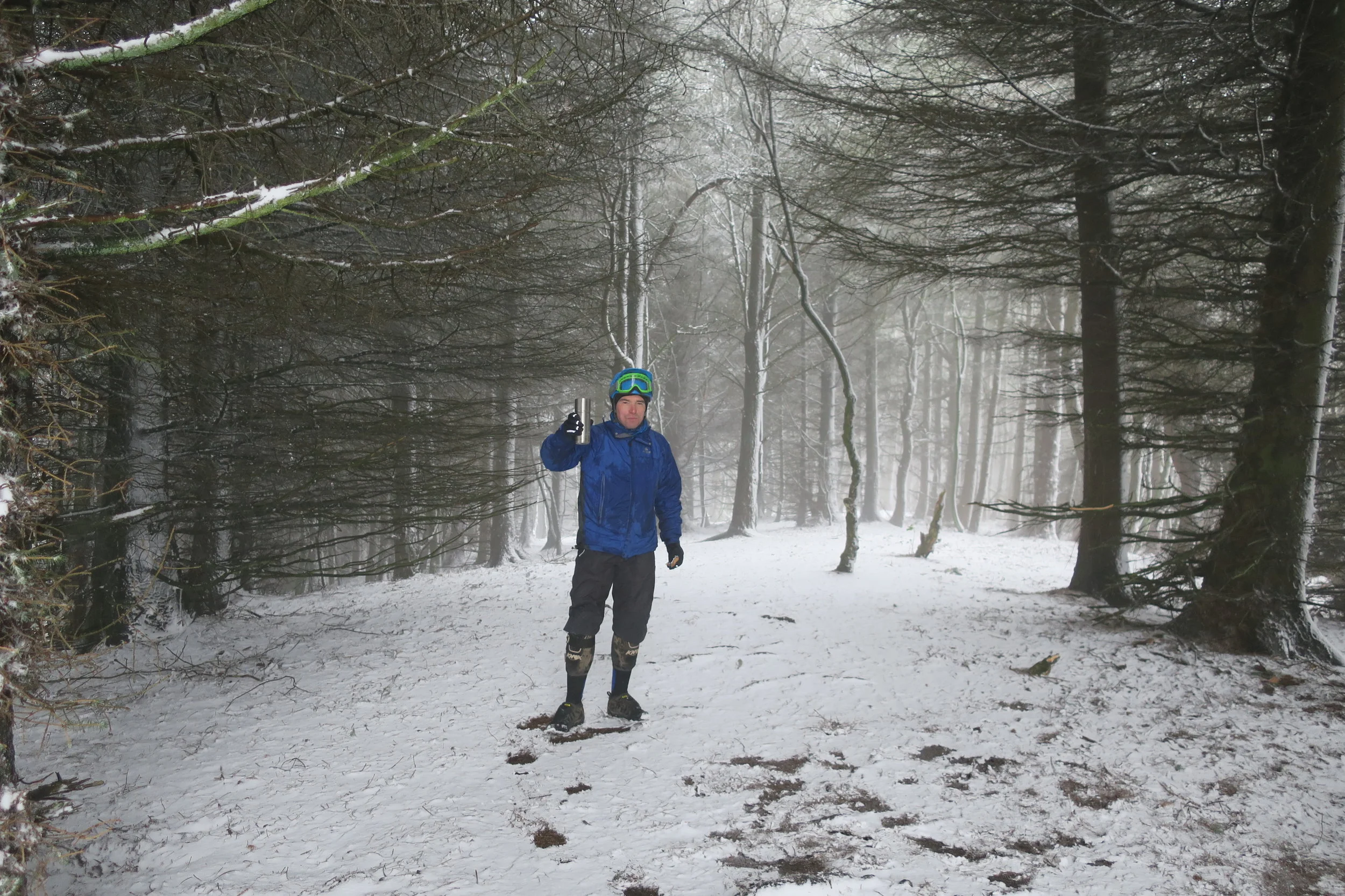
Wednesday 24th of June was forecast to be the hottest day of the year, but it was the date I had planned for so I packed plenty of food and water and set off. Riding from home, I was in for an 85Km day - the routes listed below are shorter as I first had to get to the trailhead.
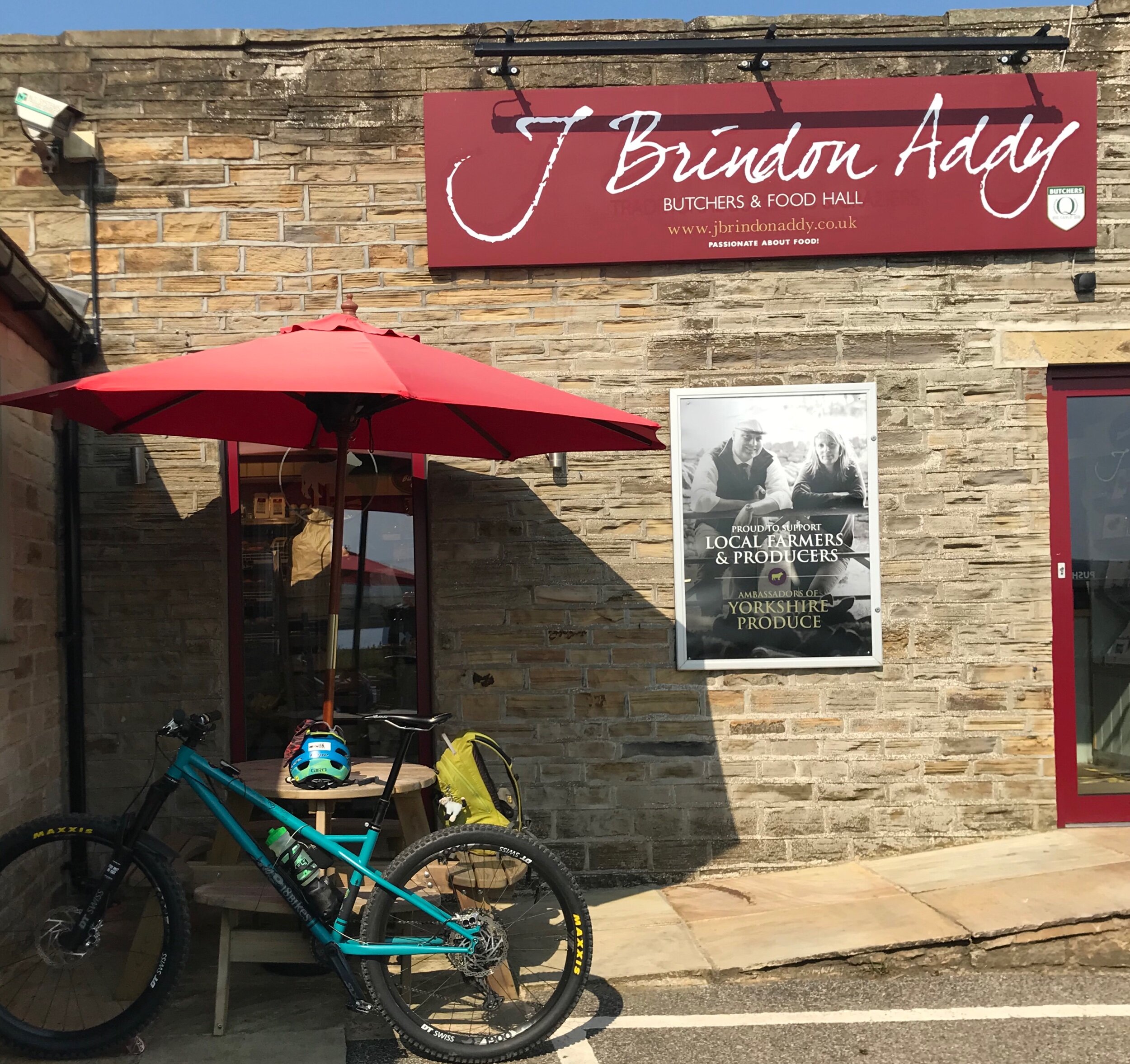
Home of the best Pork Pie
My first stop was J Brindon Addy’s Butchers home of the best pork pies in the world. With a couple in my pack for lunch, I set off. Climbing out of Hade Edge I was soon off road and descending the rough and rocky trail known as Ramsden Road. Holme Moss summit was tantalisingly close in front of me and as I emerged from trail to tarmac near Lane village there were already plenty of road bikers tackling the long climb to the top. But I was going down, heading through Holme Village towards Digley Reservoir, and the climb up Nether Lane and Springs Road with its old grooved flagstones worn by the passing of horse and carts many many years ago.
A brief stint on the A635 led to a right turn at Snoopy’s Cafe, a conveniently placed butty van where the Pennine Way crosses on its descent from Black Hill/Soldiers Lump. It’s a popular stop for passing motorists and an institution for some.
I was now heading down the Wessenden Valley towards Marsden. This descent has a mix of wide gravel tracks, steep stone pitched sections and bracken edged singletrack. Ride Kirklees advocacy group have carried out some trail maintenance on some of the boggy sections, reinstating some old drains, but today it was hard packed, dry and fast.
A long descent in the bag, it was time to climb up out of West Yorkshire and drop down into Greater Manchester. Spinning the legs steadily up past Marsden Golf Club I was soon at the permissible Bridleway of the Standedge Trail, traversing the moor above Redbrook Reservoir and avoiding the busy A62.
At the side of Brunclough Reservoir with the villages of Diggle, Uppermill and Greenfield far below, I stopped for lunch and let the legs recover. Dropping into the valley, a friendly resident kindly topped up my water bottles. It was here that I also met Duncan Philpott, legendary mountain bike photographer and Stefan Amato founder of PannierCC. They were out on their gravel bikes and, having set off from Wortley near Sheffield, it turned out that they were tracking a similar route to me.

Wise words from Tameside Council
Bottles filled, we rode on to pick up the Pennine Bridleway, a fast flat section between Diggle and Greenfield. The gravel bikes sped off into the distance, but our routes would soon split anyway as they stuck to the smoother old railway line and canal towpath while I followed the Pennine Bridleway, first on good tracks over to Carrbrook, then rougher rockier trails into the Brushes Valley. From here, it was steady climbing up the valley towards Higher Swineshaw Reservoir.
It was nice to get a brief respite from the heat as the climb started up a tree lined private road to Higher Swineshaw Reservoir. Soon enough though, it was back out into the open and into the full heat of the day. The temptation for a dip in the reservoir was strong.
I continued up and over to Tintwistle on excellent tracks, rocky in places with a feeling of isolation dropping into Ogden Clough and passing another opportunity for cooling dip in the brook.
At Tintwistle, I had a choice. Depending on how I felt, I could either drop down onto the Trans Pennine / Longdendale Trail for a fast blast on the disused railway of the old Sheffield to Manchester Line, or stick with the original game plan of following as close to the Saddleworth Massif as possible.
With plenty of food and water and feeling good, I decided to stick to the plan and followed the Northern Horse Route as it wove its way alongside the very busy A628, criss crossing its way up the valley. I thought this section would be a laborious slog with the noise of the road taking away any sense of peace and tranquility, but there was a strange feeling of calm as I rode along empty trails, comprising of old lanes, disused railways and wooded singletrack, with the only occasional noise of the road reminding me of life outside of my little bubble of turning the pedals.
The perfectly placed Crowden Campsite provided my second water refill of the day and I stopped to chat to the warden about the current lockdown situation and the effect it was having on the camping and caravanning industry.

St James Church, Woodhead
I pushed on up the valley passing the quaint St James’ church where some of the navvies who died during the construction of the Woodhead Tunnels are said to be buried.
Shortly after passing the church, I was on a section where I thought I might have to brave the road, passing the turning on the left up the backside of the Holme Moss (A6024) and crossing Woodhead bridge before turning off the road again below Pikenaze Hill. However, there is a permissible Bridleway (thank you Northern Horse Route) which heads up and alongside the A6024, crossing this at Oakside Bridge before heading back towards the A628 and back up the Woodhead Valley towards the Longdendale trail where it crosses from Derbyshire into South Yorkshire at Salter’s Brook Bridge.

Nearing the end of a long day……
From here you cross the busy A628 for the last time, directly opposite the Dunford Bridge road and head down towards the village. Turning left just before reaching the bottom of the hill, towards Winscar Reservoir, and riding over the dam wall and through the car park, means that you cut off a big chunk of road climbing. It’s then just a short way to the top before the descent down Snittle Road back to Hade Edge and a well earned beer.
I on the other hand had another 10k to ride home!
With my legs beginning to stiffen, I made my way back on quiet roads happy that the route was everything and more than I hoped it would be.
So there you have it a big day out around a big old lump of moorland.
What are the trails like?
Most are well surfaced rocky trails and only a few sections along the Northern Horse Route would be boggy in wet weather. I was surprised how little actual road work there was considering the distance covered, I cannot give you an actual ratio but all the roads I took were quiet back lanes, and the only real traffic hazards are the A635 and crossing the busy A628.
What Bike would you recommend?
A short travel trail bike would certainly be a comfortable option on some of the more rocky sections of the route, but I rode it on my 18 bikes, No7, 27.5” hardtail and it was more than up to the task.
As I mentioned earlier, I bumped into Duncan and Stefan who were doing a similar route to me but on their gravel bikes, so I would say as long as you were ok with rocky loose terrain you’d be fine on a gravel bike - just be prepared for punctures and a bit of pushing/carrying.
I will put two route files below, one for mountain bikes and one more suited to gravel bikes. Which you choose is entirely up to you.

Stunning views all day long
Are there facilities en-route?
At the time of riding and writing, we were in a the grip of a global pandemic and most cafes and pubs were closed. But if you’re reading this when the world is back up and running, then there are numerous places to stock up en-route as you pass through the villages of Holme, Marsden, Uppermill and Greenfield. Crowden Campsite has a little shop, but this was closed at the time of writing as was the small shop/brew stop at the side of the Fleece pub in Holme Village. Then there’s also Snoopy’s Butty Van (maybe seasonal) on the A635 Greenfield Road.
Where’s the best starting point?
There are plenty of places to start the route. However, I wanted to get the more technical trails out of the way while my legs were still fresh, so I would say the best place to start is Hade Edge and go in an anti clockwise direction as I did. That way you get a nice roll in to the finish and you can drive down to Holmfirth for a pint in Magic Rock Tap (once the pubs are allowed to open again post lockdown)
How long will it take me?
Expect to have a long day. With stops for food, admiring the views, photos and route finding, I was out for nearly 8 hrs.
MTB Route,
All the tough ups and downs….
42miles 4921ft ascent or 66Km 1500m ascent approx…..
https://www.komoot.com/tour/209027754?ref=itd
Gravel Route…..
I have taken out some of the roughest sections and included the Trans Pennine Trail in the Longdendale Valley. There are still some sections where good bike handling skills will be required.
40 Miles 4275ft Ascent or 64Km 1300m ascent approx….
https://www.komoot.com/tour/209030323?ref=itd
Enjoy and let me know how you get on 👍
The Advocacy Way GPX File
Download the GPX file for the Advocacy Way.
The Advocacy Way
Looking for a challenge this summer?
Fed up of riding round in circles?
How about a linear route with a difference?
Start your journey with a night at The Dales Bike Centre where Stu and his team will look after you. After a hearty breakfast, away you go.
The route follows great bridleways and quiet roads, eventually finishing at Cafe Adventure.
Don’t underestimate it though!
As I found out over the August Bank Holiday weekend in 2018, this ride is no pushover. There are some tough climbs and challenging descents along the way but you’ll be treated to stunning and ever changing scenery.
So here it is the GPX file for ‘The Advocacy Way’
Any questions about the route please get in touch via my contact page.
The Advocacy Way: Day 3
Read about the third and final day in Ride Holme’s bike packing challenge to raise funds for the BMC Mend Our Mountains Cut Gate project.
Bank holiday Monday.
It was all supposed to be over by now and today was the day for kicking back and relaxing with my wife.
However, I had unfinished business to attend to.
After a hot meal, a warm bath and a good nights sleep, I woke refreshed. Although my ankle was playing up after all the pedalling and pushing, I was determined to get to Hope and finish my challenge.
I left home at around 10am to cycle the 6 miles back to where I had left the route the night before.
It was during these 6 miles that I seriously thought of quitting. My ankle was agony, my Achilles' tendon had really tightened up and I was in pain. All sorts of thoughts were running through my head. the most disturbing one being “what if it snaps as I'm approaching the top of Cutgate?”.
Thankfully, I finally found a pedalling position that eased the pain by lowering my saddle by half an inch.
Game on!
Arriving at Langsett, I started to meet other bikers out riding the trails, chatting and telling them about my ride. Walkers were also taking advantage of the better weather, they were also greeted with a smile and a cheery hello.

I was soon on my own again as I started the long technical climb along Mickleden Edge and then onward to the summit. After the long, hot summer, the bogs that this whole quest is about were practically none existent - but the erosion caused by those avoiding them at their worst was still evident to see.
Up at the cairn I stopped and chatted to more bikers before the long descent to Cranberry Clough.

With no bike packing kit on my bike, I could enjoy this descent to the full and soon enough I was pedalling along the shores of a very empty Derwent reservoir.
My route then took me on some of the classic trails of the Peak District, including the fantastic Hagg Farm Zig Zags. Thanks to the gentleman from Hull, out on his Santa Cruz, for getting the gates on this great descent.
Along the edge of Ladybower, I came to the final climb of the day and the whole challenge - aptly named locally as ‘Shit Bastard’. By the time I reached the top, I was on the ridge below Win Hill and could almost see the finish line.
I had one last blast downhill on the Roman Road towards Hope. Upon arriving at the gate marking the end of the off road section, I was greeted by Jacquie who had been following my progress all day on Strava Beacon.
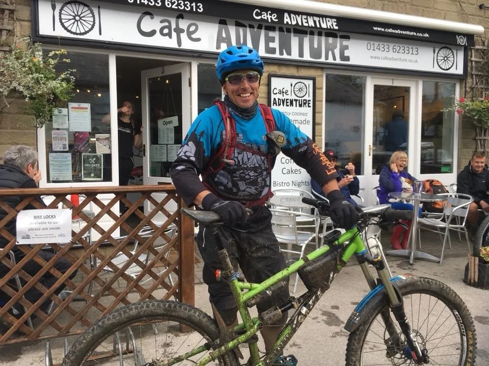
There were smiles all around and we shared the final road section to Cafe Adventure where my sister and brother-in-law were there with my nieces to welcome me home across the finish line.

So that was it, I'd done it.
It was not quite in the style I would have liked, but I had laid down a route to follow.
Overall it was a excellent challenge in the fact that it really pushed me, and not just because of Sunday's weather. Some sections were an absolute joy to ride, while others gave me that real "what the hell am I doing here" feeling.
The weather on Sunday certainly was a test of character, but once you're out in it, it's not that bad really. I was lucky in that I had the right clothing for the job and had spent the day feeling relatively comfortable.
I also find it quite easy to lose myself in my own thoughts and so the hours out on my own, just turning the pedals, we're almost meditative.
Can't Quit was my mantra.....

Would I do things differently next time?
To be honest, there was little that I would have changed.
I’d take some lights to allow me to carry on into the night, but I reckon that 10-12hrs of riding is enough for anyone. However, if I'd had lights, I could have taken more breaks instead of just ploughing on.
Other than adding in a lighter for the stove, I think I got things pretty spot on.
So there you have it ..........
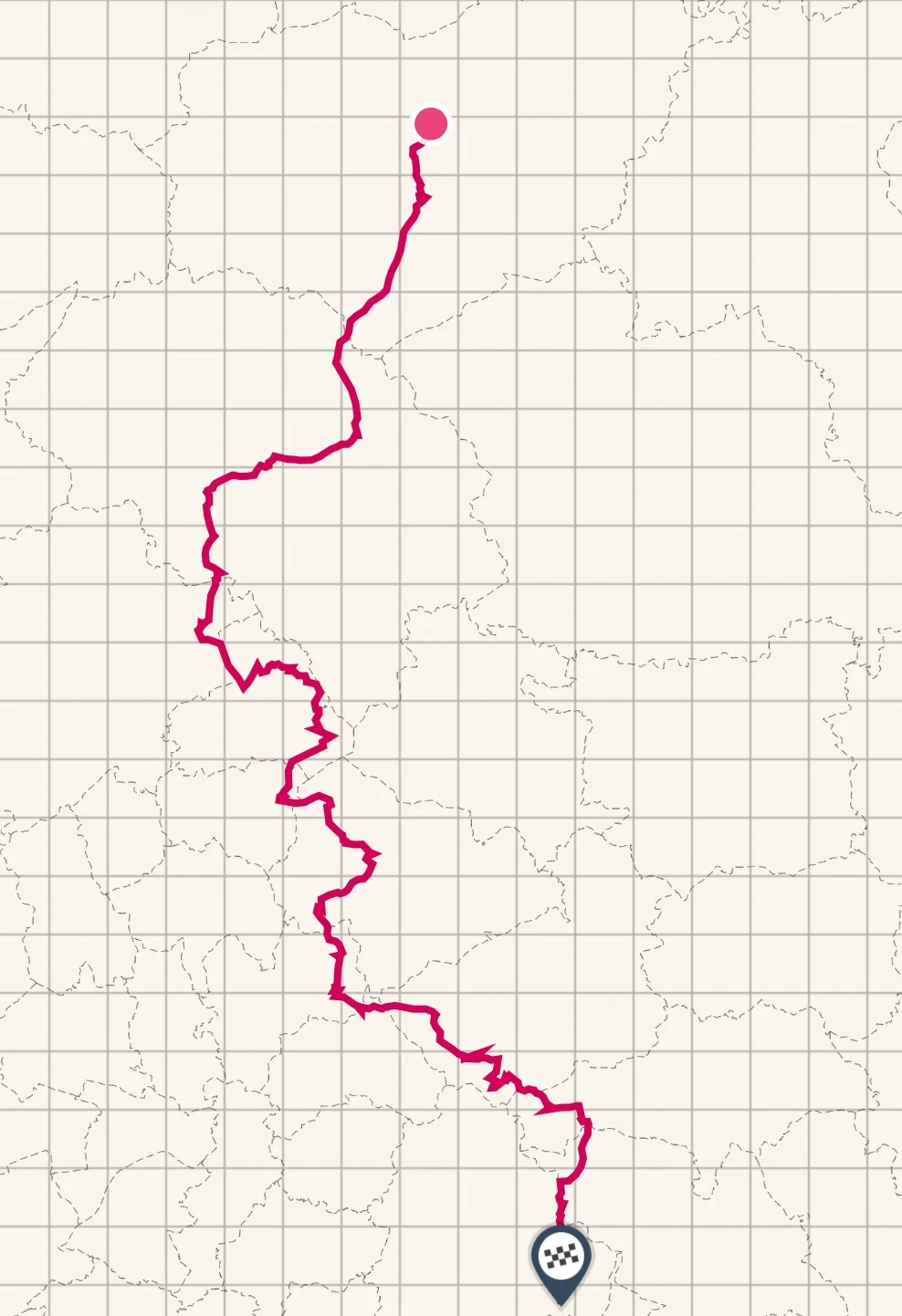
The Advocacy Way
153 miles. 246 km.
16,300 ft of ascent. 4,970 m of ascent.
Click here for the GPX file
Any questions just ask... 👍

The Advocacy Way: Day 2
Day 2 of Ride Holme’s epic bike packing challenge to raise funds for the BMC Mend Our Mountains Cut Gate Project was a long, cold and very wet day in the saddle.
Having completed Day 1 of my challenge, I was tucked up in my sleeping bag underneath a tarp somewhere en route.
I tossed and turned, finally sleeping soundly between 1.00am and 5:30am. Wanting to be on the road before daybreak, I reluctantly got out of my warm sleeping bag and packed everything away. The first pedal turned as the clock struck 6.00am.
With bad weather forecast, I wanted to give myself the best start and planned to get to Hebden Bridge before stopping for a real breakfast (caffeine gel and snickers does not a breakfast make).
Back on the trail, I met Paul Kirkham who was out for an early morning blast before the rain came in. Although our destinations were very different, we shared the same route for a good while. It was nice to have a bit of company and we chatted as the miles floated by.

On the descent to Widdop Reservoir, the weather began to close in. We met a couple of bikers coming the other way, having set off from Sheffield the day before on their own mission of riding the Pennine Bridleway. They too were concerned what the weather had in store for us later.
We wished them well and carried on, saying our goodbyes. I headed down through Hardcastle Crags towards Hebden Bridge as Paul headed home.

By now the rain was coming down hard.
Arriving in Hebden Bridge, soaking wet and in need of a good feed, the good people at Blazing Saddles bike shop let me store my bike inside while I went for breakfast. In Hebden, for me, there's only one place to go and so I headed to Mooch Cafe and luckily got the last seat in the house.
A bucket of coffee and a full English was the order of the day. Make that two buckets of coffee!
I left with a full belly and a warm rosy glow.
Heading back to the bike shop, I chatted shop before stocking up on Happy Bottom Butter (is there really a better name for chamois cream) to keep the chafing at bay and set off.

Anyone who has visited Hebden Bridge will know it's nestled a steep sided valley, so the climb was as tough as I thought it would be. The pouring rain made even the cobbled roads a slippery challenge.

I pressed on, once again finding myself on the Pennine Bridleway and the old packhorse trails that criss cross the moors around these parts. Descending to the canal at Summit I received a text from Jacquie saying she had just missed me at Mankinholes and was waiting just ahead of me at the Summit Inn. Her beaming smile cheered me up no end as I rolled on the towpath in the downpour.
We headed for the pub and I stood outside under the smokers' shelter while Jacquie went in for drinks. A few minutes later she came out saying that the landlady, on hearing of my quest, insisted that I came inside out of the weather. So, with my bike stored safely in the beer garden, I went inside to a very warm welcome. Several cokes and a bowl of chips later, I left with a small donation. Thank you!
My journey now took me over the moors once again and across a very busy M62. My life felt like it was a million miles away from those thundering past below.

This section proved quite tiresome and nondescript as the weather closed in even more. I rode on through thick mist and heavy drizzle. Up and down past several reservoirs, I was starting to flag. My enthusiasm was waning through a culmination of the weather and the homogeneous reservoir access tracks I was now riding.
Then I heard a shout up ahead. Jacquie had again followed my progress and was waiting for me by the Rams Head pub on the A672. She passed on some messages of support which I'd been receiving through her takeover of my social media accounts, giving me a much needed boost.
Crossing the A640 I was heading for home territory and a trail I'd wanted to ride for a long time. The descent into Marsden must be one of the best in the area, a real mix of flagged sections, boardwalks and fast singletrack, proving what can be done with properly planned and managed trail repairs and maintenance.

My arrival into Marsden coincided with a group heading for the train station all dressed up for a night on the town. I didn't envy them one bit and I'm pretty sure the feeling would be mutual.
It was here that I met Jacquie again. She asked me how I was and if I was going to continue on from here or call it a day, but with several hours of day light left and being on home soil as it were I said I would press on, and so I did.
The only thoughts going through my head now were of the hills I had left to climb, and the slight disappointment I felt at not staying out another night to complete the challenge in the style I had planned. A message from my sister saying I'd earned the right to a hot bath and warm bed after being out all day helped with my decision to head for home.
The hills proved easier than I expected and I was soon on the final stretch of tarmac before the point at which I had chosen to end the day. This short stretch of road was the hardest part of the day. I really needed to dig deeper than ever.
I really had given it my all today, and it was starting to show.
With my Garmin turned off and a short message recorded for social media, I headed home for a warm bath, a hot meal and my bed. Luckily I had tailwind to take me the last 6 miles home.
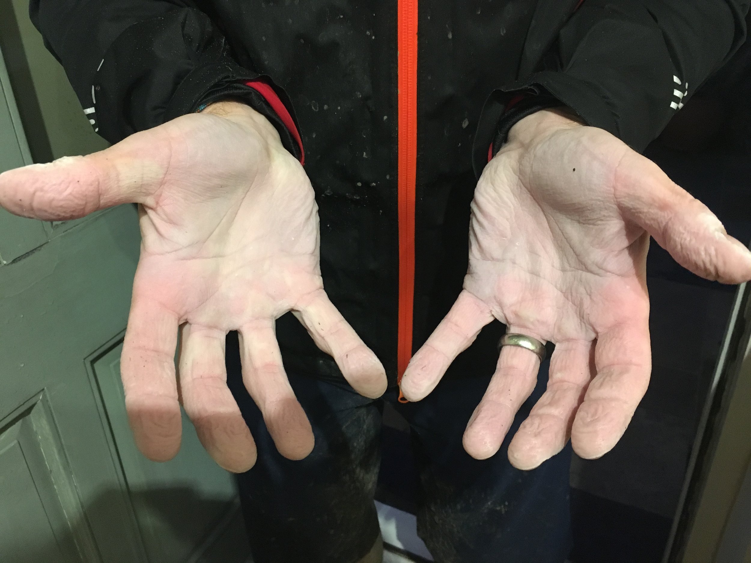
I finally stepped through the door at 9.00pm, a full 15 hours after leaving the field just outside Earby. I was tired, broken and my hands and feet were like prunes.
I thought that was it, my Challenge was over and I couldn't carry on.
Until I heard more messages of support saying that I deserved a night at home having endured the worst weather of the entire summer. Others were urging me to finish what I'd started and so I went to bed satisfied that I'd done my best and that I would see in the morning whether I had the energy to finish the job off.

The Advocacy Way: Day 1
Smiles for miles as Ride Holme sets off on his epic 3 day back packing challenge to raise money for the BMC Mend Our Mountains Cut Gate project.
Having been involved in two fundraising events for the Mend Our Mountains Cut Gate campaign (MTB Dolly's Mixer, riding from Hayfield to Lady Cannings just outside Sheffield, and the Steel Valley Ride, a circular route starting and finishing at Fox Valley Stocksbridge), I thought it was time for me to organise my own.
Wracking my brains as to what I could do, I literally had that Eureka moment while soaking in the bath.
I thought why not link my two favourite biking destinations, the Dales Bike Centre in Reeth, North Yorkshire to Cafe Adventure in Hope, Derbyshire. As a bonus it would also mean linking the various advocacy group areas along the way.
I decided to name it the ‘Advocacy Way’.
Not long after coming up with the idea, I made my plans known to Cut Gate campaigner, and member of Peak District MTB, Keeper Of The Peak. That was it - no going back, although I still had to create the route and pick a suitable date in which to do the ride.
Now everyone loves a good map and lucky for us we have an account with Ordnance Survey so we have the whole of the UK at the click of a mouse.
After a few hours staring at the screen, I had a line on a map.
Although the route would be going through areas I knew well, over 50% of the route would be unknown ground. I had no idea what to expect, all I knew is that I had to stick to bridleways and byways, no cheeky footpaths (except in emergencies).
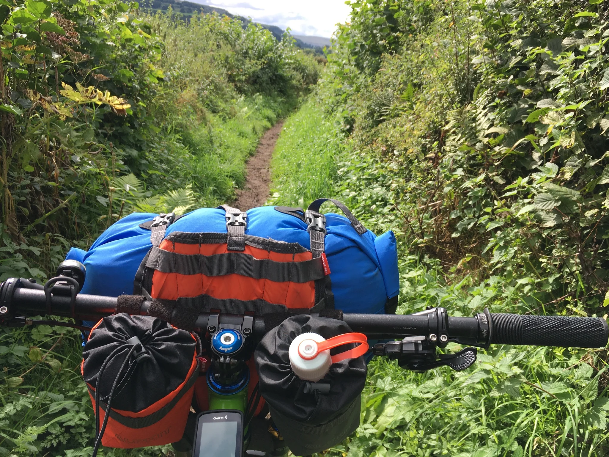
Over the summer my better half, Jacquie Budd Outdoor-Girl.com, and I honed our bike packing skills with a few local trips, plus a 10 day trip to the Outer Hebrides.

To give me the best chance of completing the route it was decided that the August Bank Holiday would be a good time and with the weather we've enjoyed all summer, I was hoping for good conditions.
With our accommodation booked for the Friday night, I set up a Just Giving page and watched as the donations came in.
In the weeks leading up to the start I had a few anxious moments about the enormity of the challenge I had set myself, but on the whole I was excited at the thought of the adventure ahead.
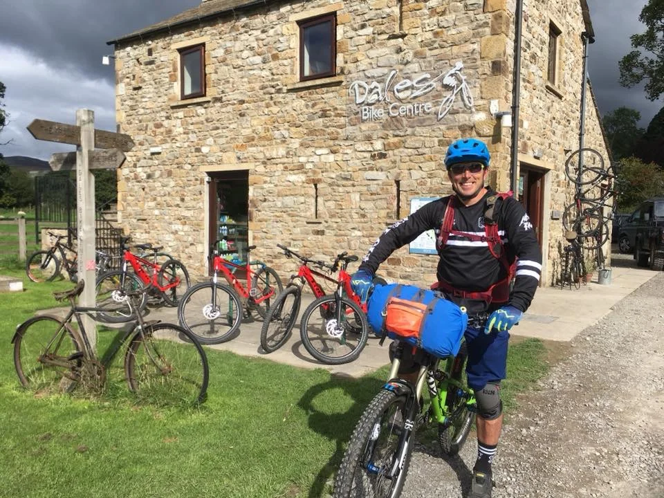
Friday the 24th August came around soon enough and with the van loaded, we headed north on the A1. We were soon clear of all the traffic heading to the Leeds Festival and with the A1 upgrade complete we made good time getting to the Dales Bike Centre.
After a good meal and a few pints in The Bridge Inn, Grinton, it was back to the DBC for a final kit check and to sort out the maps I would be needing for the trip.
If you've only ever visited Dales Bike Centre on Ard Rock weekend, you’ll not have experienced the peace and quiet that the place has to offer - and the fact it has dark sky status means you're pretty much guaranteed a good night’s sleep.
The plan was to rise early, load up the bike and head off straight after my coffee and obligatory bacon butty. However, this went out of the window as other guests readied themselves for the day ahead and we all got chatting about our plans for the day.
In the end I left DBC a little later than planned. At just after 10.00am, I rolled out of the car park and made my way south. The first hill of the day was a real wake up call as I pedalled up past the YHA and out onto the moors.

The weather could not have been better, beautiful blue skies with just a scattering of fluffy clouds. A perfect day for a bike ride.
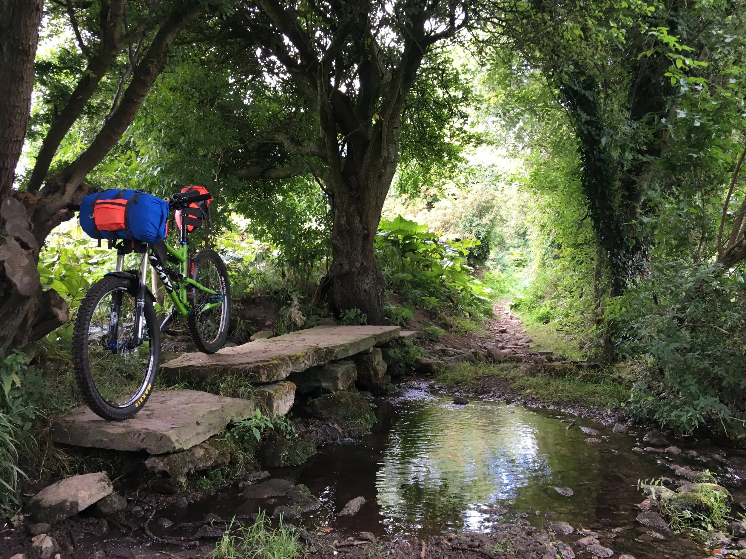
As my legs warmed up I settled into a steady rhythm. Dropping down past Castle Bolton I headed for the river, with Stu's [Dales Bike Centre] words ringing in my ears. Having seen the route I’d planned, he remarked that he wasn't too sure about the stepping stones over the river. I took his comment in jest.
The bridleway to the river was stunning, an old sunken lane with clapper bridge over a small beck. My mind wandered until I rounded a corner and there they were - or there they should have been, had the river not been high enough to completely cover every single stepping stone.
I stood and weighed up my chances, until finally common sense prevailed. I got out the map and looked for a detour.
Taking a diversion through the tourist hotspot of Aysgarth, I was soon back on track. After a fair stretch of road work I was began climbing up onto Walden Moor. Indistinct bridleways made route finding tricky and slow going...but it was never meant to be easy.
The descent into Starbottom was a treat, made all the more exciting with a fully loaded bike.
Out onto the road I was now heading into familiar territory.
I rolled into Kettlewell much later than anticipated and had a very late lunch at the cafe.
I also took this opportunity to check in with Jacquie who was a little concerned that it had taken so long to cover the first 25 miles. I reassured her that now I was on familiar ground the miles would soon fly by.
Leaving Kettlewell I cycled past Kilnsey crag, with climbers hanging around on my right and the show field getting prepared for the upcoming Kilnsey Show on my left. I was soon back climbing again, this time up Mastiles Lane - or ‘the wall’ as I like to call it as it stretches out in front of you, with your neck craning to see the top.

Under normal circumstances I relish these types of climbs, but with a loaded bike and many more miles still to go I knew that I had to pace myself, so I pushed the final steep section before rolling over the crest and descending the other side.
Onto Gargrave, I had a pit stop at the Co-op before heading for the canal. By now I was eating up the miles and my thoughts were turning towards finding a spot to bivvy for the night. I reasoned that as I hadn't planned to cycle through the night I would pedal until it was dark and find a spot in a suitable field, and so I pressed on.
I knew a large section of this part of the route would be on the Pennine Bridleway and found it to be well signposted, although its reputation for having lots of gates was proving to be true.
With darkness falling, I found a corner of a field suitably tucked away and settled down for the night.

Super Noodles and a hot chocolate were to be my treat of a supper but sadly my stove decided otherwise and failed to light. I had plenty of gas, it was the ignition system that failed. I even had a back up piezo, but even that wouldn't light the thing. So it was no hot meal for me, just a half eaten pasty, a snickers and a slurp of water.
I lay there thinking of the day’s events, and what was to come.
An almost full Moon rose over the horizon with Mars for company as I slowly drifted off to sleep, waking occasionally to the sound of owls screeching and foxes yapping.